 Technology Extrapolation Domains
| Do you want to download the data from GYGA? Please read the license information here. |
| Are you working in a private company and you want to use the data from GYGA? Please read the Licensing and sponsorship page. |
Coverage and download links
Below outlines the current coverage of Technology Extrapolation Domains (TEDs) in GYGA. Do you have a specific request, e.g. to have TEDs for other region added? Please contact us!
If you are working for a private company and you want to have a copy of the TEDs, then you can access the data sets via the University of Nebraska-Lincoln (UNL) marketplace:
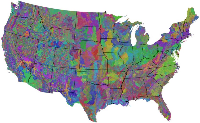
Download the technology extrapolation domains for the United States
Download the technology extrapolation domains for Sub-Saharan Africa
If you are working for a non profit organization or a private company with an active sponsorship subscription, then you can contact Patricio Grassini (pgrassini2@unl.edu) to get the data sets.
Data sources and delineation of GYGA-TEDs
Each GYGA-TED is a unique combination of a GYGA-CZ and water storage capacity in the rootable soil depth, the latter defining the root zone plant-available water holding capacity (RZPAWHC). GYGA-TEDs were created for Africa and US. The methodology used to develop the TEDs is described below. Details and uses of the TEDs are provided elsewhere (Rattalino Edreira et al., 2018; Andrade et al., 2019.
Africa GYGA-TED
Plant-available soil water holding capacity in the root zone was taken from the Africa Soil Information Service (AfSIS; http://www.isric.org/projects/afsis-gyga-functional-soil-information-sub-saharan-africa-rz-pawhc-ssa version April 2015, af_agg_ERZD_TAWCpF23mm__M_1km.tif, with a resolution of 1 × 1 km). RZPAWHC is determined by evaluation and spatial interpretation of the AfSIS soil profile database:
- the so-called "legacy" soil point data (Africa Soil Profiles database v1.2;18,500 points) and
- all AfSIS sentinel site soil point data (approx. 9,600 points, including spectral data and 10% wet chemistry reference data), which were provided by AfSIS for this collaboration,
- SoilGrids1km layers (www.isric.org/explore/soilgrids) produced at ISRIC using global models; updated and fine-tuned fitting a continental model, with finer resolution satellite data and above mentioned soil data, resulting in AfrSoilGrids250m (www.isric.org/projects/africa-soilgrids-soil-nutrient-maps-sub-saharan-africa-250-m-resolution).
As a component of the GYGA-TED spatial framework, RZPAWHC values are classified into nine 25 mm classes, with =< 50 mm and >250 mm as lower and upper classes, respectively.
This classification of the variables resulted in the following ranges:
| RZWHC (mm) | RZWHC Value |
| 0 - 50 | 100000 |
| 50 - 75 | 200000 |
| 75 - 100 | 300000 |
| 100 - 125 | 400000 |
| 125 - 150 | 500000 |
| 150 - 175 | 600000 |
| 175 - 200 | 700000 |
| 200 - 225 | 800000 |
| 225 - 250 | 900000 |
| > 250 | 1000000 |
US GYGA-TED
Plant-available soil water holding capacity in the root zone was taken from gSSURGO database (Soil Survey Staff; Resolution of 250 × 250 m). There are two classifications, both based on the RZPAWHC values. For the fine TEDs the RZPAWHC values are classified into thirteen 25 mm classes, with 0-25 mm and >300 mm as lower and upper classes, respectively. For the coarse TEDs the RZPAWHC values are classified into seven 50 mm classes, with 0-50 mm as the lower class and >300 mm as the upper class.
This classification of the variables resulted in the following ranges:
| RZWHC (mm) | RZWHC Value |
| 0 – 25 | 100000 |
| 25 – 50 | 200000 |
| 50 – 75 | 300000 |
| 75 – 100 | 400000 |
| 100 - 125 | 500000 |
| 125 – 150 | 600000 |
| 150 – 175 | 700000 |
| 175 – 200 | 800000 |
| 200 – 225 | 900000 |
| 225 – 250 | 1000000 |
| 250 – 275 | 1100000 |
| 275 – 300 | 1200000 |
| > 300 | 1300000 |
| RZWHC (mm) | RZWHC Value |
| 0 – 50 | 100000 |
| 50 - 100 | 200000 |
| 100 - 150 | 300000 |
| 150 - 200 | 400000 |
| 200 - 250 | 500000 |
| 250 – 300 | 600000 |
| > 300 | 700000 |
| Some small areas within climate zones were considered irrelevant for technology transfer and removed from the original US GYGA-CZs scheme. Inclusions were removed when (i) they covered an area < 350,000 ha, (ii) the surrounding climate zone was, at least, 5 times larger, and (iii) standard deviation for terrain elevation was <10% (USDA-FSA-APFO, 2016). This rule aims to discard small inclusions attributable to an artefact of climate zones computations while keeping small CZ that portray microclimates caused by changes in temperature and precipitation due to complex topography. These refined climate zones were combined with the PAWR map to create the TED maps.
Values of the GYGA-TEDs Value for each cell indicates the unique combination of soil type and climate for that cell. The value of the GYGA-CZs is constructed by the sum of the three GYGA-CZ variables and for the GYGA-TEDs and the value of the RHWHC variable is added to the GYGA-CZ value. A few examples: |
| GYGA-RZWHC value | 100000 |
|
| GYGA-CZ Value GDD | 1000 + |
|
| GYGA-CZ Value AI | 0 + |
|
| GYGA-CZ Value Temperature seasonality | 01 |
| GYGA-RZWHC value | 800000 |
|
| GYGA-CZ Value GDD | 6000 + |
|
| GYGA-CZ Value AI | 800 + |
|
| GYGA-CZ Value Temperature seasonality | 01 |
| GYGA-RZWHC value | 1000000 |
|
| GYGA-CZ Value GDD | 10000 + |
|
| GYGA-CZ Value AI | 400 + |
|
| GYGA-CZ Value Temperature seasonality | 02 |
References
Andrade JF, Rattalino Edreira JI, Farrow A, van Loon MP, Craufurd PQ, Rurinda J, Zingore S, Chamberlin J, Claessens L, Adewopo J, van Ittersum MK, Cassman KG, Grassini P (2019) A spatial framework for ex-ante impact assessment of agricultural technologies. Global Food Security 20, 72-81
Rattalino Edreira JI, Cassman KG, Hochman Z, van Ittersum MK, van Bussel L, Claessens L, Grassini P (2018) Beyond the plot: Technology extrapolation domains for scaling out agronomic science. Environmental Research Letters 13, 054027
Hijmans, R.J., Cameron, S.E., Parra, J.L., Jones, P.G. & Jarvis, A. (2005) Very high resolution interpolated climate surfaces for global land areas. International Journal of Climatology, 25, 1965-1978.
Licker, R., Johnston, M., Foley, J.A., Barford, C., Kucharik, C.J., Monfreda, C. & Ramankutty, N. (2010) Mind the gap: how do climate and agricultural management explain the ‘yield gap' of croplands around the world? Global Ecology and Biogeography, 19, 769-782.
Monfreda, C., Ramankutty, N. & Foley, J.A. (2008) Farming the planet: 2. geographic distribution of crop areas, yields, physiological types, and net primary production in the year 2000. Global Biogeochemical Cycles, 22
Mueller, N.D., Gerber, J.S., Johnston, M., Ray, D.K., Ramankutty, N. & Foley, J.A. (2012) Closing yield gaps through nutrient and water management. 490, 254-257.
Soil Survey Staff, National Value Added Look Up (valu) Table Database for the Gridded Soil Survey Geographic (gSSURGO) Database for the United States of America and the Territories, Commonwealths, and Island Nations served by the USDA-NRCS., (2016)
New, M., Lister, D., Hulme, M. & Makin, I. (2002) A high-resolution data set of surface climate over global land areas. Climate Research, 21, 1-25.
Trabucco, A., Zomer, R.J., Bossio, D.A., van Straaten, O. & Verchot, L.V. (2008) Climate change mitigation through afforestation/reforestation: A global analysis of hydrologic impacts with four case studies. Agriculture, Ecosystems and Environment, 126, 81-97.
Van Bussel, L.G.J., Grassini, P., Van Wart, J., Wolf, J., Claessens, L., Yang, H., Boogaard, H., de Groot, H., Saito, K., Cassman, K.G. & Van Ittersum, M.K. (2015) From field to atlas: Upscaling of location-specific yield gap estimates. Field Crops Research, 177, 98-108.
Van Wart, J., Van Bussel, L.G.J., Wolf, J., Licker, R., Grassini, P., Nelson, A., Boogaard, H.L., Gerber, J., Mueller, N.D., Claessens, L.F.G., Van Ittersum, M.K. & Cassman, K.G. (2013) Use of agro-climatic zones to upscale simulated crop yield potential. Field Crops Research, 143, 44-55.
You, L., Wood, S. & Wood-Sichra, U. (2006) Generating global crop maps: from census to grid. In: IAAE (International Association of Agricultural Economists), Annual Conference, Gold Coast, Australia.
You, L., Crespo, S., Guo, Z., Koo, J., Sebastian, K., Tenorio, M.T., Wood, S. & Wood-Sichra, U. (2009) Spatial Production Allocation Model (SPAM) 2000 Version 3 Release 6, http://mapspam.info/.
Zomer, R.J., Trabucco, A., Bossio, D.A. & Verchot, L.V. (2008) Climate change mitigation: A spatial analysis of global land suitability for clean development mechanism afforestation and reforestation. Agriculture, Ecosystems and Environment, 126, 67-80.